I'm a geospatial developer at Sparkgeo. I have also worked as a geospatial consultant at Forte Consulting, a GIS Developer at WSP Group, a multidisciplinary engineering company in the UK.
I have a Master of Science (MSc) degree, with distinction, in GIS and a Bachelor of Science (BSc) degree in Geology and Physical Geography from the University of Edinburgh.
Contact Me
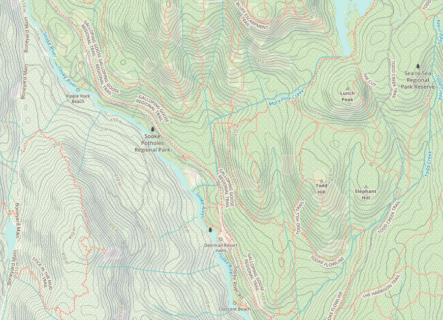
Topo Trail Map
This map was created to help people get outside and explore. The aim was to replicate some of the features of the high quality and widely available UK Ordnance Survey paper maps. In British Columbia it is often difficult to find topographic maps at a suitable scale that compete in terms of up to date trail and backroad information.
OpenStreetMap was the obvious choice for this map as it has extensive, crowd sourced, trail and point of interest data. Mapbox Studio was used to design the map and the styling is based on the Mapbox Outdoors style, but a number of modifications and tweaks have been made to improve its legibility as a printed map and to highlight important features for outdoor recreation. Trails have been made clearer with increased line width, brighter colours and improved labelling. Forest cover and points of interest like mountain peaks, campgrounds and pubs have been added. Names of urban areas have been given more prominence.
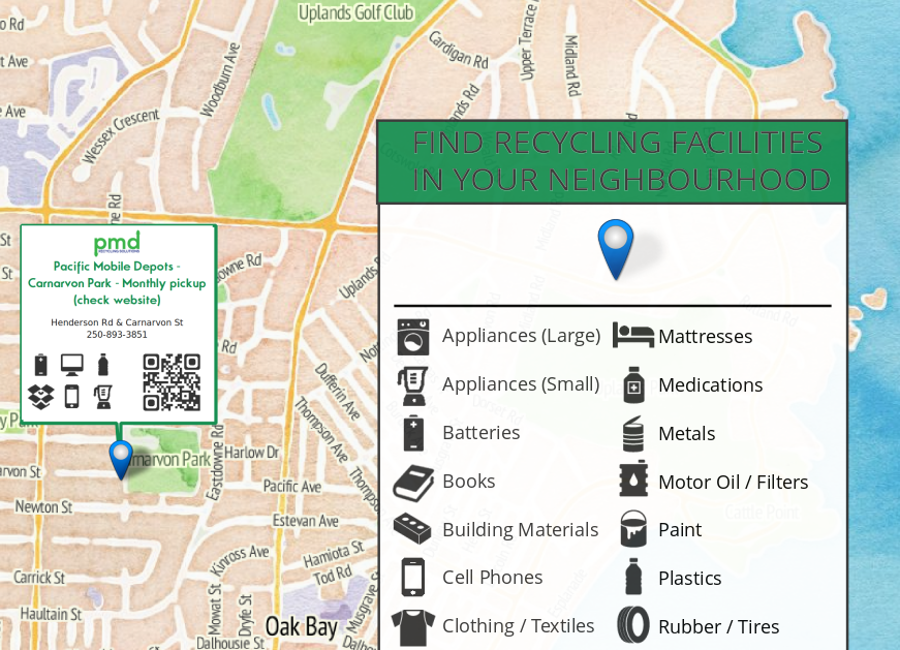
This poster is displayed in public places and apartment buildings around Victoria. It shows nearby locations where people can recycle common household items.
The map was originally envisioned by Bruce Mackenzie and after meeting him at a GeoGeeks Meetup, he put me in charge of the design and development side of things. I used a variety of open source tools to display a combination of local knowledge and data from the Capital Region District on top of Stamen Design's Watercolor basemap. The map is database driven and new versions can be rolled out when recycling facilities change.More information can be found here.
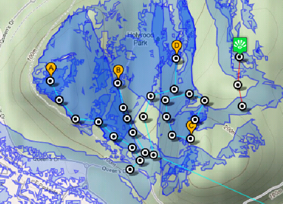
SARMApp (Search and Rescue Mapping App) is a mobile web app to aid search and rescue operations in the field. It geolocates and tracks members of a ground-based search team and performs viewshed analysis on-the-fly based on digital terrain data.
I designed and developed the app as part of my MSc in GIS thesis project. It was developed as a mobile web app instead of a native app so it could be used on any mobile OS. While developing the application, I had to overcome and work around a number of technical challenges with the web map technology available in 2010. I have plans to reboot the project to harness modern web and mapping technologies to reduce its reliance on server side geoprocessing and map tiles (mobile data coverage can be poor in the field).
The application was awarded the Royal Institute of Chartered Surveyors Geomatics Prize in 2010 and I subsequently wrote an article about it which was published in their Land Journal magazine. The article is available here.
Date:
May-August 2010
Technologies & Skills:
Web Development, Web Mapping, Google Maps API, HTML5 Geolocation API, Server Side Geoprocessing, Viewshed Analysis, GDAL/OGR, PostGIS, LiDAR
Attribution:
Google (2010) - Data SIO, NOAA, U.S. Navy, NGA, NEDCO, DigitalGlobe, GeoEye, Getmapping plc, IBCAO, Infoterra Ltd & Bluesky, The GeoInformation Group